Field Books & Templates · · 1 min read
Chain & Link Conversion Table
In the world of land surveying, legacy systems often linger longer than expected. One such legacy system is the use of Chain and Link units—once the standard…

In the world of land surveying, legacy systems often linger longer than expected. One such legacy system is the use of Chain and Link units—once the standard for recording distances in field books and Tippan drawings, especially in older cadastral maps across India.
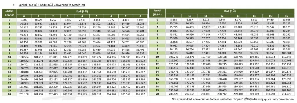
The Chain & Link Conversion Table [HD Image] is an essential reference sheet that allows surveyors and GIS professionals to instantly convert traditional units (like 1 chain = 66 feet or 100 links) into modern metric equivalents. Whether you’re digitizing old Tippan drawings or validating historic land records, this visual aid ensures clarity and accuracy during the conversion process.
The table includes:
Visual mapping of chain-link units to meters
Helpful Gujarati notation (શૃંખલાઓ – કડીઓ) for regional familiarity
Direct usability in rural survey offices and training environments
This resource is not just a utility—it preserves the bridge between India’s survey heritage and its digital future.