- All Posts
- Aerial
- Digital Workflow
- Ground
- Hydro
- Jobs & Work
- Other
- Back
- Total Station
- DGPS
- Dumpy Level
- LiDAR
- Other
- 360° Camera
- Camera
- Back
- RGB Drone
- Thermal-Drone
- Multispectral Drone
- LiDAR Drone
- Satellite
- Other
- 360° Camera Drone
- Back
- CAD
- GIS
- Digital Twin
- Processing
- Other
- Tools
- Back
- Other
- Single Beam Echo Sounder
- Multi Beam Echo Sounder
- Camera
- Back
- Give Job
- Get Job
- Give Work


Trishunya Survey Solutions: Elevate Your Project with Unmatched AccuracyFrom urban master plans to coastal hydrography, Trishunya delivers turnkey surveying services—combining...
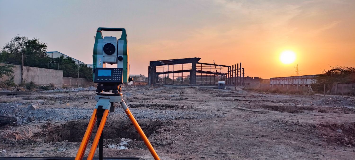
🎯 Our Expertise: High-precision Total Station & DGPS Surveys Accurate Control Network Establishment Detailed Topographic & Terrain Mapping Safe, compliant...
- All Posts
- Aerial
- Digital Workflow
- Ground
- Hydro
- Jobs & Work
- Other
- Back
- Total Station
- DGPS
- Dumpy Level
- LiDAR
- Other
- 360° Camera
- Camera
- Back
- RGB Drone
- Thermal-Drone
- Multispectral Drone
- LiDAR Drone
- Satellite
- Other
- 360° Camera Drone
- Back
- CAD
- GIS
- Digital Twin
- Processing
- Other
- Tools
- Back
- Other
- Single Beam Echo Sounder
- Multi Beam Echo Sounder
- Camera
- Back
- Give Job
- Get Job
- Give Work

In coastal and riverine environments, tidal variations are critical to understand. This Tidal Level Log lets you track water levels...

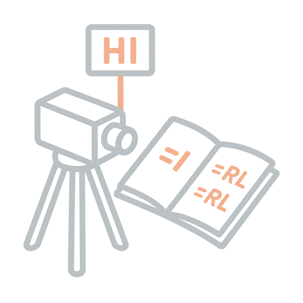
Traversing is the backbone of many land surveys, and the Theodolite is the trusted instrument for measuring angles with high...
The Rise and Fall method brings clarity to undulating terrain. It allows surveyors to explicitly note how the ground level...
- All Posts
- Aerial
- Digital Workflow
- Ground
- Hydro
- Jobs & Work
- Other
- Back
- Total Station
- DGPS
- Dumpy Level
- LiDAR
- Other
- 360° Camera
- Camera
- Back
- RGB Drone
- Thermal-Drone
- Multispectral Drone
- LiDAR Drone
- Satellite
- Other
- 360° Camera Drone
- Back
- CAD
- GIS
- Digital Twin
- Processing
- Other
- Tools
- Back
- Other
- Single Beam Echo Sounder
- Multi Beam Echo Sounder
- Camera
- Back
- Give Job
- Get Job
- Give Work
Trishunya Survey Solutions: Elevate Your Project with Unmatched AccuracyFrom urban master plans to coastal hydrography, Trishunya delivers turnkey surveying services—combining...
🎯 Our Expertise: High-precision Total Station & DGPS Surveys Accurate Control Network Establishment Detailed Topographic & Terrain Mapping Safe, compliant...
- All Posts
- Back
- CAD
- GIS
- Digital Twin
- Processing
- Other
- Tools