- All Posts
- Aerial
- Digital Workflow
- Ground
- Hydro
- Jobs & Work
- Other
- Back
- Total Station
- DGPS
- Dumpy Level
- LiDAR
- Other
- 360° Camera
- Camera
- Back
- RGB Drone
- Thermal-Drone
- Multispectral Drone
- LiDAR Drone
- Satellite
- Other
- 360° Camera Drone
- Back
- CAD
- GIS
- Digital Twin
- Processing
- Other
- Tools
- Back
- Other
- Single Beam Echo Sounder
- Multi Beam Echo Sounder
- Camera
- Back
- Give Job
- Get Job
- Give Work

🧮 Surveyor Calculator A smart calculator built for surveyors and civil engineers, running fully offline in the browser.Beyond standard arithmetic,...

How to Use? 🧩 Polygon Partition Tool A specialized offline polygon partitioning tool built for land surveyors, civil engineers, and...
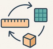
🧭 Surveyor Multi-Converter A powerful all-in-one offline conversion tool designed for land surveyors and civil engineers.It helps in linear, area,...
- All Posts
- Aerial
- Digital Workflow
- Ground
- Hydro
- Jobs & Work
- Other
- Back
- Total Station
- DGPS
- Dumpy Level
- LiDAR
- Other
- 360° Camera
- Camera
- Back
- RGB Drone
- Thermal-Drone
- Multispectral Drone
- LiDAR Drone
- Satellite
- Other
- 360° Camera Drone
- Back
- CAD
- GIS
- Digital Twin
- Processing
- Other
- Tools
- Back
- Other
- Single Beam Echo Sounder
- Multi Beam Echo Sounder
- Camera
- Back
- Give Job
- Get Job
- Give Work

The Dumpy Level remains a reliable workhorse in elevation surveys and is still widely used in construction and land leveling...

Drones have become indispensable in modern surveying, offering faster data collection and access to difficult terrains. However, to maintain regulatory...

When it comes to geodetic-level accuracy, Differential GPS (DGPS) is the gold standard. But even with advanced instruments, proper data...
- All Posts
- Aerial
- Digital Workflow
- Ground
- Hydro
- Jobs & Work
- Other
- Back
- Total Station
- DGPS
- Dumpy Level
- LiDAR
- Other
- 360° Camera
- Camera
- Back
- RGB Drone
- Thermal-Drone
- Multispectral Drone
- LiDAR Drone
- Satellite
- Other
- 360° Camera Drone
- Back
- CAD
- GIS
- Digital Twin
- Processing
- Other
- Tools
- Back
- Other
- Single Beam Echo Sounder
- Multi Beam Echo Sounder
- Camera
- Back
- Give Job
- Get Job
- Give Work
🧮 Surveyor Calculator A smart calculator built for surveyors and civil engineers, running fully offline in the browser.Beyond standard arithmetic,...
How to Use? 🧩 Polygon Partition Tool A specialized offline polygon partitioning tool built for land surveyors, civil engineers, and...
🧭 Surveyor Multi-Converter A powerful all-in-one offline conversion tool designed for land surveyors and civil engineers.It helps in linear, area,...
- All Posts
- Back
- CAD
- GIS
- Digital Twin
- Processing
- Other
- Tools
🧮 Surveyor Calculator A smart calculator built for surveyors and civil engineers, running fully offline in the browser.Beyond standard arithmetic,...
How to Use? 🧩 Polygon Partition Tool A specialized offline polygon partitioning tool built for land surveyors, civil engineers, and...
🧭 Surveyor Multi-Converter A powerful all-in-one offline conversion tool designed for land surveyors and civil engineers.It helps in linear, area,...