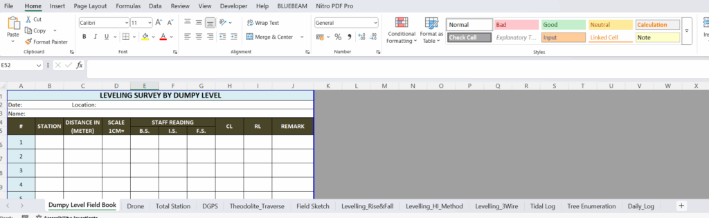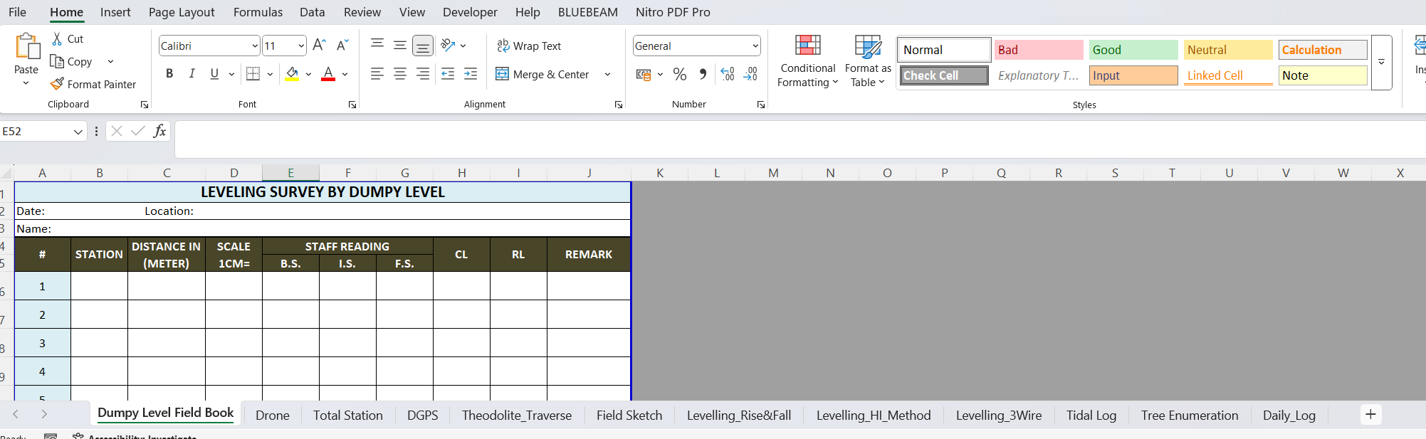
Managing multiple types of surveys often leads to multiple field book formats—each with its own structure and quirks. This Excel resource is a complete package of standardized templates covering nearly all types of field surveying activities.
What’s inside?
-
Ready-to-use Excel sheets for DGPS, Drone, Theodolite, Dumpy Level, Total Station, and more
-
Pre-formatted columns with formulas and dropdowns where applicable
-
Space for signature, date, remarks, and calculations
-
Consistent design across formats for smoother team training and report compiling
This file is perfect for field teams, students in geomatics, private survey agencies, or government field staff. Use it to reduce documentation errors and standardize your workflow.